Weather Forecast
Moderator: Moderators
-
Sav

- Rank 5

- Posts: 588
- Joined: Mon 18 Sep 2006 17:01
- Contact:
This may helpMarguerite & Steve wrote:Can someone explain Humidity to me, and what is mean in %'s .
Quote: Humans are very sensitive to humidity, as the skin relies on the air to get rid of moisture. The process of sweating is your body's attempt to keep cool and maintain its current temperature. If the air is at 100-percent relative humidity, sweat will not evaporate into the air. As a result, we feel much hotter than the actual temperature when the relative humidity is high. If the relative humidity is low, we can feel much cooler than the actual temperature because our sweat evaporates easily, cooling us off. For example, if the air temperature is 75 degrees Fahrenheit (24 degrees Celsius) and the relative humidity is zero percent, the air temperature feels like 69 degrees Fahrenheit (21 C) to our bodies. If the air temperature is 75 degrees Fahrenheit (24 C) and the relative humidity is 100 percent, we feel like it's 80 degrees (27 C) out.
http://science.howstuffworks.com/dictio ... ion651.htm
You should be comfortable & hopefully no need for straighteners today
Cheers Sav
-
Sav
- Rank 5
- Posts: 588
- Joined: Mon 18 Sep 2006 17:01
- Contact:
http://www.blitzortung.org
If you are using the radar, then the strikes are colour coded.
I've also discovered that they change colour as time increases between strikes
So apologies for any earlier storm reporting confusion
White = 20 mins
Yellow = 20-40 mins
Light Orange = 40-60 mins
Dark Orange = 60-80 mins
Red = 80-100 mins
Dark Red = 100-120 mins
Cheers Sav
Last edited by Sav on Sun 19 Sep 2010 18:24, edited 1 time in total.
-
Sav
- Rank 5
- Posts: 588
- Joined: Mon 18 Sep 2006 17:01
- Contact:
http://www.bbc.co.uk/news/magazine-11380925thumbelina wrote: The trees are GROANING under the weight of all of the fruit, nuts and berries - old wives tales say that that is the sign of a long, hard winter!!
The leaves did seem reluctant to colour while we were in the PO
When leaves fall early,
Fall and Winter will be mild;
When leaves fall late,
Winter will be severe.
Squirrels gathering nuts in a flurry,
Will cause snow to gather in a hurry.
Keep your eyes peeled
http://www.stormfax.com/wxlore.htm
Cheers Sav
-
thumbelina
- Rank 5
- Posts: 811
- Joined: Wed 22 Oct 2008 22:00
- Contact:
-
Sav
- Rank 5
- Posts: 588
- Joined: Mon 18 Sep 2006 17:01
- Contact:
Quote: If the garden is not suitable, or you have no garden, then consideration may be given to mounting a screen on a north facing wall. There is a problem in this case with possible contamination from heat energy emitted by the building itself. A practical compromise would be to use such a wall, but carry the screen/shield away from the wall on a bracket - this would allow a free airflow around the equipment. A distance of 20-25 cm for an unshielded sensor has been suggested, and this would certainly minimise any contamination from the walls. For a shielded (or screened) sensor, then 10 cm or so has been suggested as a useful distance. Even a north wall mounting needs watching around the summer solstice, particularly at more northern latitudes, as care needs to be taken to shield the thermometers/sensors from early morning and late evening sunshine with an unobstructed horizon to the northeast or northwest.thumbelina wrote:To be fair, Sue, it's been cold all day up here; the temp hasn't risen above 8° (north facing wall in the shade, obviously!)
http://weatherfaqs.org.uk/node/124
I'm not a perfectionist
Cheers Sav
-
Sav
- Rank 5
- Posts: 588
- Joined: Mon 18 Sep 2006 17:01
- Contact:
Hi all
Forecasts
We are fortunate that Meteociel gives us a facility, where we can peruse the weather for a certain city/town in France.
Here in the UK we are reliant on the model output on each run ( as there is no local guide )
So we then have to analyse the data, to come up with what the weather might be doing.
http://www.wetterzentrale.de/
This forecast would comprise of a general overview
Example
http://www.meteociel.fr/modeles/gfs/pre ... ons/3h.htm
But the UK would not be broken into sections
Now no forecast is perfect, so the output you see on your own locale, does not mean the weather is going to entirely conform.
At the bottom of the page, Meteociel tells us that the information is taken from the raw data of the GFS & that forecasts are only an indication, this also includes estimations of temp & wind, which can be misleading.
Now as far as my own interpretation of the forecast is concerned
Bearing in mind the 18Z does not roll out until later in the evening
I have to convey to you in the best way possible, what the weather may bring the following day.
On a difficult day, where the PO has received the kitchen sink of weather.
Its not easy to break it all down, for the short output on AD.
Example: Mainly cloudy means more cloud, but don't rule out a clear interval.
Also as has been pointed out, the close proximity of the mountains, which can make a big difference on the weather, as we have seen from pictures & reports from local people.
So what do we take from all my rambling
That i am gratefull we have this outlet via Meteociel & even if it just gives us a guide for the following day, then that can only be a good thing.
Cheers Sav
-
Sav
- Rank 5
- Posts: 588
- Joined: Mon 18 Sep 2006 17:01
- Contact:
We would have to conduct an experiment, to see a better conclusion to the wind debate ( no i'm not talking beans )john wrote:Well,have spent the morning down on the coast again (St Cyp and P Vendres) and again it was much calmer down there than here,thus once more exploding the "the tram is always stronger on the coast than the hills" old wives' tale.
Yes it is windier in exposed parts & on the coast
That's only going by my experience of watching the models & spending time in the PO
Drive from Ceret to Argeles ( wind increases ) & then back again during the Tramontane ( wind decreases ) & the same usually applies to the temps.
Quote: The aspect of the weather that tends to affect the lifestyle of coastal dwellers the most is the wind.
http://www.coastalgardens.com/book2.html
Some more info
Quote: The Tramontane is a violent, cold wind, characteristically and markedly turbulent, which blows from between W and NW, descending the foothills of the Pyrenees (into Spain) and the hills of the southern Massif Central and travelling through the Gateway of Naurouze (Lauragais) between the Côte de la Malepere and Razès and the Montagne Noir, before sweeping the coastal plains of lower Languedoc and Roussillon. [readers will note the similarity with the description of the Cers]
This regional/local wind presents a number of analogies with the cold Mistral:
1. it blows in all seasons, but with more vigour in winter and spring
2. it blows in gusts
3. it is often very strong and agricultural activities, homes and routeways need protection from it.
4. it accelerates as it passes through narrow, deep corridors of land
http://www.qondio.com/local-winds-in-sw-france
It could quite easily fit with the funneling effect from Arles sur Tech & then gradually opening out to reach the coast ( Port Vendres/Cap Bear etc ) where the winds are the strongest.
I have reported during windy episodes & the strongest winds are allways centered by the sea.
The Tram is a gusty wind, so its probable there will be lulls during its progress & you could be in a sheltered area.
Anyway hopefully the above article will help regards wind & may your clothing remain atached to your pegs
Cheers Sav
Last edited by Sav on Thu 16 Dec 2010 19:19, edited 1 time in total.
-
Sav
- Rank 5
- Posts: 588
- Joined: Mon 18 Sep 2006 17:01
- Contact:
john wrote: I never cease to be impressed by just how accurate Meteociel is. They promised this FW would abate after 16h00,and here it is, 16h35,and ,yes,it really has noticeably lessened in the last 45mins !
Meteociel stands out from the crowd, because it allows us to see an experimental breakdown of the model for most French cities & towns.
If we were to use the model itself, then it would be a SE France forecast, similar to what you get on the local TV Meteo, which i must say is pants
No wonder Savo wins all these awards if he uses them as his source.
Cheers Sav
-
Serge
-
Sav
- Rank 5
- Posts: 588
- Joined: Mon 18 Sep 2006 17:01
- Contact:
There are allways variables, elevation will also impact on wind speed.john wrote: You are quite right that often the wind is stronger by the coast,but,by no means always.
The strongest winds I've ever experienced on the coast are,perhaps unsurprisingly, when the wind's been coming in off the sea.
http://www.newton.dep.anl.gov/askasci/w ... a00160.htm
Plus if you go higher, there's assistance to get you back to Anglaterre quickly
http://en.wikipedia.org/wiki/Jet_stream
Cheers Sav
-
Sav
- Rank 5
- Posts: 588
- Joined: Mon 18 Sep 2006 17:01
- Contact:
Quote: Once the forecast is written, it is sent out to the Maritime and Coastguard Agency, so all the coastguard stations in the UK receive a copy of the forecast. It is also sent to the BBC as well as going on the Met Office website.john wrote: Thanks for explaining all that Sav. Taught me a lot of stuff I never knew.
Glad it helped
So,in a nutshell,the height,position of the place (eg aspect of the valley),and direction of the wind, relevant to it ,is at least as important to the wind's strength as it's basic pressure led speed?
Which would go a long way to explaining why the wind was stiffer than normal up at Thumbers'gaff (and mine) than it was on the coast yesterday.
Being in the Pyrenees & you & thumbers are in the mountain height's, weather can change very dramatically & in a very short time.
If the forecast is dry, it could be raining higher up the mountain.
The same would apply to the wind etc & dependant if you have a wind break around your property, which would deflect the worst effects.
Mountains = Variable
If your walking especially, it might be fine on the plain, but could be very different up above.
On a similar note,why do the media make such a big thing about wind speeds/gusts at places like Cap Bear,Cap Creus,and (in UK) Cape Wrath? To me it seems obvious that winds would be stronger on exposed headlands like that. But fairly irrelevant. What people REALLY want to know is the wind strength in populated areas. For example I'd be far more interested in the wind,and its potential for damage in Perpignan,Céret, or St Cyprien.
Anton stresses that the main aim of the forecast is the safety of lives at sea: "The forecaster will always try and be as accurate as possible," he said.
"But if there is a large range of winds, say from Force 2 up to Force 7, the forecaster will always concentrate on the stronger winds as they have the greatest implications for the safety of people.
"Sometimes that can be at the expense of the lighter winds that don't get a mention."
http://news.bbc.co.uk/local/devon/hi/pe ... 961585.stm
So taking into account that Port Vendres is a main shipping harbour, then the focus will fall on them more with regards to ships/boats entering & leaving the docks.
I'm wondering if there's a french shipping forecast
Cheers Sav
-
Sav
- Rank 5
- Posts: 588
- Joined: Mon 18 Sep 2006 17:01
- Contact:
Hi johnjohn wrote: Nothing that a couple of weeks' good spring downpours (preferably overnight...) will not solve.
Ever since I've been involved with this area,this has always been a dry time of the year,and,(Sav will correct me if I'm wrong on this) February is,statistically,the driest month in PO.
Unfortunately the spring rains will not add greatly to the water table, so any snow during the winter is welcome.
I have got some stats for Perpignan going back 5 years, in relation to Feb precipitation.
2006 - Feb - 11mm
http://www.meteociel.fr/climatologie/vi ... annee=2006
2007 - Feb - 84mm
http://www.meteociel.fr/climatologie/vi ... annee=2007
2008 - Feb - 5.2mm
http://www.meteociel.fr/climatologie/vi ... annee=2008
2009 - Feb - 27.8mm
http://www.meteociel.fr/climatologie/vi ... annee=2009
2010 - Feb - 49.4mm
http://www.meteociel.fr/climatologie/vi ... annee=2010
Bearing in mind that the rainfall totals will be greater in those areas closer to the mountains
Winter is still young & perhaps we may be reflecting differently when the spring arrives
Cheers Sav
-
Sav
- Rank 5
- Posts: 588
- Joined: Mon 18 Sep 2006 17:01
- Contact:
Hi john & alljohn wrote: Trouble is ,Sav those are just the figures for Feb alone. We need to look at all the months over a longer period . I remember reading somewhere that on average Feb is the driest month here. Is that the case?
Taking an average from 1974-2004
http://www.creme-de-languedoc.com/Langu ... istics.php
Feb does stand out as one of the dry month's, July leading the pack being as its a summer month.
Cheers Sav
Last edited by Sav on Mon 31 Jan 2011 23:51, edited 1 time in total.
-
Sav
- Rank 5
- Posts: 588
- Joined: Mon 18 Sep 2006 17:01
- Contact:
Thank you for taking the stats to the present day thumbersthumbelina wrote:Taking the statistics from January 2003 - December 2010, February is the third wettest month of the year. October, January and February are the three wettest. July, June and August are the three driest.
There is no denying that October was wet in 2010 with some 173.9 mm of rain. But 2010, as a whole, was the fourth driest year since 2003. Following on from 2007, 2009 and 2008.
Just goes to show how our climate is allways changing
Cheers Sav
-
Sav
- Rank 5
- Posts: 588
- Joined: Mon 18 Sep 2006 17:01
- Contact:
Hi all
Weather is such a great subject & it's always changing
Our planet has gone through many cycles & will no doubt go through many others as time goes by.
It has seen very warm periods & very cold ones, long before cars/aircraft etc.
If you believe some of the scientists, the earth stopped warming in 1998.
http://news.bbc.co.uk/1/hi/8299079.stm
Also sun spots are on the decline & could impact our future climate
http://news.nationalgeographic.com/news ... e-science/
We have observed that there have been many events that have impacted the world in recent times, weather, earthquakes, volcanoes etc.
Is this just another one of those cycles that has happened before ?
Time will tell, but no matter what we do to assist the climate, at the end of the day Mother Nature will probably have the final say.
As far as rainfall in June is concerned, up until today not a great deal has been recorded in Perpignan since the beginning of the month.
http://www.meteociel.fr/climatologie/vi ... annee=2011
Those early days did deliver a lot of rainfall & the current total stands at 42.6mm
Records going back to 2002, show this month as having record rainfall in recent times.
Plus we are not at the end of the month yet
So yes record rainfall for Perpignan, but it would be good if we had another recording facility further inland, so we could compare results.
Time to get your rain gauges out
You could also try this
http://ga.water.usgs.gov/edu/sc2.html
Cheers Sav
-
Sav
- Rank 5
- Posts: 588
- Joined: Mon 18 Sep 2006 17:01
- Contact:
Devastating news on a seemingly safe trip outKate wrote:Terrible - no words can express what the family must be feeling.
http://www.express.co.uk/posts/view/254 ... ls-climber
The mountains can be a dangerous place at all times of the year
Make sure you check the conditions for the day ahead, it may be fine at ground level, but can be very different higher up.
If you spend time on the beach at Argeles, you can see the ominous clouds hovering over the Alberes at times, but they rarely encroach further down.
Check you have a good map of your route & stay together, you could find yourself walking into mist/cloud & easily lose your way.
Water is vital & make sure you carry plenty of it
Very hot days will spark of storms
The mountains of the PO are a wondefull place to wander in
Stay safe & be aware
Sav
-
Sav
- Rank 5
- Posts: 588
- Joined: Mon 18 Sep 2006 17:01
- Contact:
Hi johnjohn wrote:Something has gone sadly awry with Meteociel's predictions today,Sav. The temp is OK (though nothing much to write home about for the Med in late June) but the wind is WAY more than predicted. Certainly gusting to more than 30kph : not really possible to sit out in,without parasols etc being blown away.
The forecast is only an indication of what may transpire & we are fortunate that Meteociel offers us the facility to get a localised look at the weather
You can estimate a rough wind speed, but gusts could be anything
Quote: Les prévisions à 3 jours météo présentées ici pour Céret ( Pyrénées-Orientales ) sont expérimentales et déterminées à partir des données brutes de GFS, un modèle numérique américain, ces prévisions doivent être prises à titre indicatif. Les estimations de températures et de vent des villes d'altitude peuvent être un peu erronées. Des ajustements sont en cours.
http://www.meteociel.fr/
The only other real option is to use the main overview model
http://www.wetterzentrale.de/
Plenty of summer months left
Cheers Sav
-
Santiago

- Rank 5
- Posts: 1290
- Joined: Tue 27 Dec 2005 12:19
- Contact:
I've just come back from a meeting at Terrats to discuss the damage caused by the recent hailstorm.
Many of the vineyards between Terrats and Alenya have been hit. The hail in some places has completely stripped the vines of grapes and leaves while in others it has just smashed some of the berries, leaving them to rot on the vine.
What was looking like a very nice harvest turned into a a very poor one in just 30 minutes.
It's upsetting to not be able to have a barbecue or sit on the terrace but it's not quite so upsetting as seeing your whole year's work destroyed.
Domaine Treloar - Vineyard and Winery - www.domainetreloar.com - 04 68 95 02 29
-
Sav
- Rank 5
- Posts: 588
- Joined: Mon 18 Sep 2006 17:01
- Contact:
Bonjour a tous
Friday April 19th
GFS Model - 18Z
Breezy/windy
Mont-Louis
Cloudy with rain & a mixture of snow later
Winds mainly light NNW, breezy later in the evening - 20km/h.
Gusting to 30km/h during the evening
The maximum afternoon temp is expected to reach 5°C
Humidity high
Arles-sur-Tech
Mainly cloudy, with rain later in the afternoon/evening.
Mostly breezy - 20/25km/h, gusting up to 45km/h.
The maximum afternoon temp is expected to reach 12°C
Humidity moderate to high
Ceret
Mainly cloudy, with some rain later in the afternoon/evening.
Mostly breezy - 20/30km/h, gusting up to 50km/h.
The maximum afternoon temp is expected to reach 13°C
Humidity moderate to high
Le Boulou
Mainly cloudy, with some rain later in the afternoon/evening.
Breezy/windy - 20/35km/h, gusting up to 60km/h.
The maximum afternoon temp is expected to reach 13°C
Humidity moderate to high
Prades
Mainly cloudy, with rain later in the afternoon/evening.
Mostly breezy - 20km/h, gusting up to 40km/h.
The maximum afternoon temp is expected to reach 10°C
Humidity high
Maury
Plenty of cloud, with the chance of a few sunny intervals.
Some rain later in the afternoon/evening
Breezy - 20/30km/h, gusting up to 55km/h.
The maximum afternoon temp is expected to reach 12°C
Humidity moderate to high
Le Barcares
Plenty of cloud, with the chance of a few sunny intervals.
Staying dry
Breezy/windy - 30/45km/h, gusting up to 70km/h.
The maximum afternoon temp is expected to reach 15°C
Humidity moderate to high
Perpignan
Plenty of cloud, with the chance of a few sunny intervals.
Some rain in the evening
Breezy/windy - 25/40km/h, gusting up to 65km/h.
The maximum afternoon temp is expected to reach 14°C
Humidity moderate to high
Argeles-sur-Mer
Plenty of cloud, with the chance of a few sunny intervals.
Staying dry
Breezy/windy - 25/45km/h, gusting up to 70km/h.
The maximum afternoon temp is expected to reach 15°C
Humidity moderate to high
http://www.meteociel.fr/
Summary
Plenty of cloud across the region, with only a few places seeing some sunshine.
Rain is possible in places, with some flakes of snow in the mountains.
Breezy/windy
Temp ranging from 5-15°C
Outlook
The Tramontane stays in rampant mode, but at least the sun will shine.
http://www.rcnradio.fr/
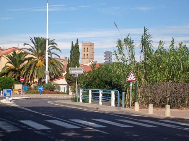
Argeles Village
Cheers Sav
Friday April 19th
GFS Model - 18Z
Breezy/windy
Mont-Louis
Cloudy with rain & a mixture of snow later
Winds mainly light NNW, breezy later in the evening - 20km/h.
Gusting to 30km/h during the evening
The maximum afternoon temp is expected to reach 5°C
Humidity high
Arles-sur-Tech
Mainly cloudy, with rain later in the afternoon/evening.
Mostly breezy - 20/25km/h, gusting up to 45km/h.
The maximum afternoon temp is expected to reach 12°C
Humidity moderate to high
Ceret
Mainly cloudy, with some rain later in the afternoon/evening.
Mostly breezy - 20/30km/h, gusting up to 50km/h.
The maximum afternoon temp is expected to reach 13°C
Humidity moderate to high
Le Boulou
Mainly cloudy, with some rain later in the afternoon/evening.
Breezy/windy - 20/35km/h, gusting up to 60km/h.
The maximum afternoon temp is expected to reach 13°C
Humidity moderate to high
Prades
Mainly cloudy, with rain later in the afternoon/evening.
Mostly breezy - 20km/h, gusting up to 40km/h.
The maximum afternoon temp is expected to reach 10°C
Humidity high
Maury
Plenty of cloud, with the chance of a few sunny intervals.
Some rain later in the afternoon/evening
Breezy - 20/30km/h, gusting up to 55km/h.
The maximum afternoon temp is expected to reach 12°C
Humidity moderate to high
Le Barcares
Plenty of cloud, with the chance of a few sunny intervals.
Staying dry
Breezy/windy - 30/45km/h, gusting up to 70km/h.
The maximum afternoon temp is expected to reach 15°C
Humidity moderate to high
Perpignan
Plenty of cloud, with the chance of a few sunny intervals.
Some rain in the evening
Breezy/windy - 25/40km/h, gusting up to 65km/h.
The maximum afternoon temp is expected to reach 14°C
Humidity moderate to high
Argeles-sur-Mer
Plenty of cloud, with the chance of a few sunny intervals.
Staying dry
Breezy/windy - 25/45km/h, gusting up to 70km/h.
The maximum afternoon temp is expected to reach 15°C
Humidity moderate to high
http://www.meteociel.fr/
Summary
Plenty of cloud across the region, with only a few places seeing some sunshine.
Rain is possible in places, with some flakes of snow in the mountains.
Breezy/windy
Temp ranging from 5-15°C
Outlook
The Tramontane stays in rampant mode, but at least the sun will shine.
http://www.rcnradio.fr/
Argeles Village
Cheers Sav
-
Sue

- Rank 5
- Posts: 1768
- Joined: Tue 02 Dec 2008 15:08
- Contact:
-
Sav
- Rank 5
- Posts: 588
- Joined: Mon 18 Sep 2006 17:01
- Contact:
-
Sue
- Rank 5
- Posts: 1768
- Joined: Tue 02 Dec 2008 15:08
- Contact:
-
Sav
- Rank 5
- Posts: 588
- Joined: Mon 18 Sep 2006 17:01
- Contact:
-
Sav
- Rank 5
- Posts: 588
- Joined: Mon 18 Sep 2006 17:01
- Contact:
-
Sav
- Rank 5
- Posts: 588
- Joined: Mon 18 Sep 2006 17:01
- Contact:
-
Sav
- Rank 5
- Posts: 588
- Joined: Mon 18 Sep 2006 17:01
- Contact:
-
Sav
- Rank 5
- Posts: 588
- Joined: Mon 18 Sep 2006 17:01
- Contact:
Bonjour a tous
Tuesday April 23rd
GFS Model - 18Z
Becoming settled
Mont-Louis
Sunny & dry
Winds light & variable
The maximum afternoon temp is expected to reach 12°C
Humidity moderate to high
Arles-sur-Tech
Sunny & dry
Winds light & variable
The maximum afternoon temp is expected to reach 16°C
Humidity moderate to high
Ceret
Sunny & dry
Breezy at first - 20km/h
The maximum afternoon temp is expected to reach 16°C
Humidity moderate to high
Le Boulou
Sunny & dry
Breezy at first - 20km/h, gusting to 30km/h.
The maximum afternoon temp is expected to reach 16°C
Humidity moderate to high
Prades
Sunny & dry
Winds light & variable
The maximum afternoon temp is expected to reach 15°C
Humidity moderate to high
Maury
Sunny & dry
Breezy in the early hours - 20km/h, gusting up to 35km/h at first.
The maximum afternoon temp is expected to reach 18°C
Humidity moderate to high
Le Barcares
Sunny & dry
Breezy/windy in the morning - 20/35km/h, gusting up to 50km/h.
The maximum afternoon temp is expected to reach 17°C
Humidity moderate to high
Perpignan
Sunny & dry
Breezy in the morning - 20/25km/h, gusting up to 40km/h.
The maximum afternoon temp is expected to reach 17°C
Humidity moderate to high
Argeles-sur-Mer
Sunny & dry
Breezy in the morning - 20/30km/h, gusting up to 40km/h.
The maximum afternoon temp is expected to reach 17°C
Humidity moderate to high
http://www.meteociel.fr/
Summary
It will be a sunny & dry day across the region
Winds will become light
Temps ranging from 12-18°C
Outlook
Mainly settled
http://www.rcnradio.fr/
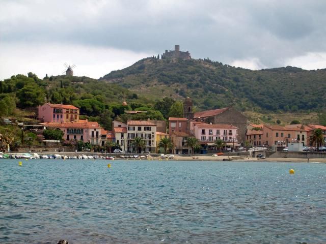
Collioure
Cheers Sav
Tuesday April 23rd
GFS Model - 18Z
Becoming settled
Mont-Louis
Sunny & dry
Winds light & variable
The maximum afternoon temp is expected to reach 12°C
Humidity moderate to high
Arles-sur-Tech
Sunny & dry
Winds light & variable
The maximum afternoon temp is expected to reach 16°C
Humidity moderate to high
Ceret
Sunny & dry
Breezy at first - 20km/h
The maximum afternoon temp is expected to reach 16°C
Humidity moderate to high
Le Boulou
Sunny & dry
Breezy at first - 20km/h, gusting to 30km/h.
The maximum afternoon temp is expected to reach 16°C
Humidity moderate to high
Prades
Sunny & dry
Winds light & variable
The maximum afternoon temp is expected to reach 15°C
Humidity moderate to high
Maury
Sunny & dry
Breezy in the early hours - 20km/h, gusting up to 35km/h at first.
The maximum afternoon temp is expected to reach 18°C
Humidity moderate to high
Le Barcares
Sunny & dry
Breezy/windy in the morning - 20/35km/h, gusting up to 50km/h.
The maximum afternoon temp is expected to reach 17°C
Humidity moderate to high
Perpignan
Sunny & dry
Breezy in the morning - 20/25km/h, gusting up to 40km/h.
The maximum afternoon temp is expected to reach 17°C
Humidity moderate to high
Argeles-sur-Mer
Sunny & dry
Breezy in the morning - 20/30km/h, gusting up to 40km/h.
The maximum afternoon temp is expected to reach 17°C
Humidity moderate to high
http://www.meteociel.fr/
Summary
It will be a sunny & dry day across the region
Winds will become light
Temps ranging from 12-18°C
Outlook
Mainly settled
http://www.rcnradio.fr/
Collioure
Cheers Sav
-
Sav
- Rank 5
- Posts: 588
- Joined: Mon 18 Sep 2006 17:01
- Contact:
-
Sav
- Rank 5
- Posts: 588
- Joined: Mon 18 Sep 2006 17:01
- Contact:
Bonjour a tous
Wednesday April 24th
GFS Model - 18Z
Mainly settled
Mont-Louis
Sunny & dry
Winds light & variable
The maximum afternoon temp is expected to reach 11°C
Humidity moderate to high
Arles-sur-Tech
Sunny & dry
Winds light & variable
The maximum afternoon temp is expected to reach 15°C
Humidity moderate to high
Ceret
Sunny & dry
Winds light & variable
The maximum afternoon temp is expected to reach 15°C
Humidity moderate to high
Le Boulou
Sunny & dry
Winds light & variable
The maximum afternoon temp is expected to reach 15°C
Humidity high
Prades
Sunny & dry
Winds mainly light & variable, breezy in the early afternoon - 20km/h.
The maximum afternoon temp is expected to reach 14°C
Humidity moderate to high
Maury
Sunny & dry
Winds mainly light & variable, breezy in the early afternoon - 20km/h.
The maximum afternoon temp is expected to reach 16°C
Humidity moderate to high
Le Barcares
Sunny & dry
Winds light & variable
The maximum afternoon temp is expected to reach 16°C
Humidity high
Perpignan
Sunny & dry
Winds light & variable
The maximum afternoon temp is expected to reach 16°C
Humidity high
Argeles-sur-Mer
Sunny & dry
Winds light & variable
The maximum afternoon temp is expected to reach 16°C
Humidity high
http://www.meteociel.fr/
Summary
It will be a sunny & dry day across the region
Winds will be mainly light
Temps ranging from 11-16°C
Outlook
Warmer but not as sunny
http://www.rcnradio.fr/
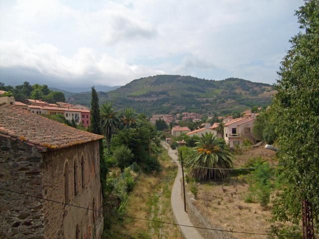
Collioure
Cheers Sav
Wednesday April 24th
GFS Model - 18Z
Mainly settled
Mont-Louis
Sunny & dry
Winds light & variable
The maximum afternoon temp is expected to reach 11°C
Humidity moderate to high
Arles-sur-Tech
Sunny & dry
Winds light & variable
The maximum afternoon temp is expected to reach 15°C
Humidity moderate to high
Ceret
Sunny & dry
Winds light & variable
The maximum afternoon temp is expected to reach 15°C
Humidity moderate to high
Le Boulou
Sunny & dry
Winds light & variable
The maximum afternoon temp is expected to reach 15°C
Humidity high
Prades
Sunny & dry
Winds mainly light & variable, breezy in the early afternoon - 20km/h.
The maximum afternoon temp is expected to reach 14°C
Humidity moderate to high
Maury
Sunny & dry
Winds mainly light & variable, breezy in the early afternoon - 20km/h.
The maximum afternoon temp is expected to reach 16°C
Humidity moderate to high
Le Barcares
Sunny & dry
Winds light & variable
The maximum afternoon temp is expected to reach 16°C
Humidity high
Perpignan
Sunny & dry
Winds light & variable
The maximum afternoon temp is expected to reach 16°C
Humidity high
Argeles-sur-Mer
Sunny & dry
Winds light & variable
The maximum afternoon temp is expected to reach 16°C
Humidity high
http://www.meteociel.fr/
Summary
It will be a sunny & dry day across the region
Winds will be mainly light
Temps ranging from 11-16°C
Outlook
Warmer but not as sunny
http://www.rcnradio.fr/
Collioure
Cheers Sav
-
Sav
- Rank 5
- Posts: 588
- Joined: Mon 18 Sep 2006 17:01
- Contact: